The entire track is 19,4 km long and was expected to take 5,5 to 7,5 hours, excluding stops. From the hotel where we stayed at, a bus dropped us off at the start of the trail and we had to be back 8 hours later, at the other side of the trekking.
There are several one-way side tracks you can take as well. Given however our scheduled pick-up, we didn’t feel comfortable spending much time on these, with the risk of not making it back in time.
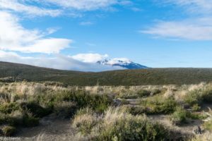
Mangatepopo Valley to Soda Springs
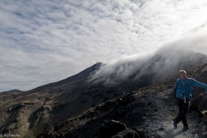
From the car park, the track makes its way up to Mangatepopo Valley. It continues at a gentle climb alongside a stream and around the edges of old lava flows.
It struck me how my husband and I were all geared up, with full packed backpacks, our hiking shoes on, different layers of clothing to be armed for changing temperatures and giving all we had. We were surrounded, as it seemed, by young hikers (in their twenties, I guess), who just had a water bottle and some snacks with them, wearing a t-shirt and some sneakers and were just passing us as like it didn’t require any effort… Another reality-check: we are getting old!
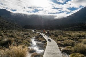
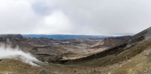
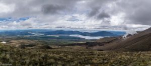
Soda Springs to South Crater
At the top of the Mangatepopo Valley, the track climbs more steadily, gaining about 340m to South Crater. I got to be honest with you: it wasn’t too easy for me at this point. My legs were feeling pretty heavy and with all this “youth” catching up on me, I just wasn’t really feeling it.
We were rewarded however, as at the top we got some great views on the surroundings where we came from. As from here onwards, I got over myself and the trek was a lot more comfortable.
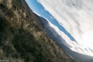
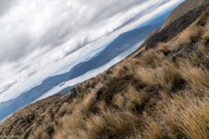
South Crater to Red Crater
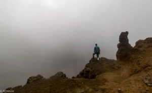
Walking up the ridge to Red Crater, we enjoyed the spectacular views to the east over the Kaimanawa Forest Park and Desert Road. From here a side trip can be taken to the summit of Mt Tongariro.
The views really depend on the weather and it changes quickly. When we just made it to the top, there was fog all around and we didn’t see anything. But then, after about 5 minutes, it cleared. We paused a bit, eating some snacks, before continuing.
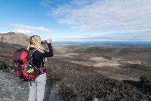
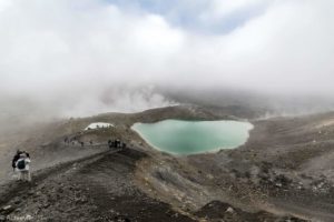
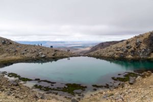
Red Crater to Emerald Lakes
The summit of Red Crater (1.886m) is the highest point on the Tongariro Alpine Crossing. From here the track descends steeply to Emerald Lakes. It’s pretty slippery with all the loose rocks and sand. The views are amazing, though – with the greenish coloured lakes. It smells because of the sulphur, of course – but who cares?
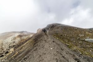
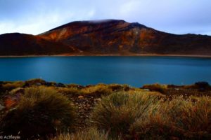
Emerald Lakes to Ketetahi Hut and to the car park
Different landscapes are visible on this part of the track. At the end, the track descends to the forest bush line, which is very much in contrast compared to the trail covered before. It got somewhat more crowded at the end, as different groups were coming together.
We eventually finished the trail after some 6 hours, so we had plenty of time left before the bus picked us up again. We relaxed a bit in the sun, as many others did. Great day.
Other Countries we visited
Have a look at the other countries we ‘achievied’ to visit, and other Achievies…


